Araba/Álava · País Vasco
Vitoria-Gasteiz
The unsung administrative capital of the whole Basque Country — big plazas, leafy parks, street art on old-town buildings and an outstanding, reasonably priced pintxo scene.
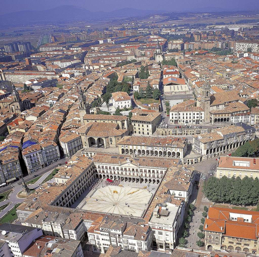

Why people fall for Vitoria-Gasteiz
Portrait drawn from Lonely Planet.
Capital of the southern Basque province of Álava (Araba), encircled by a thick belt of green, mountainous Basque countryside.
On the table. Outstanding pintxo bars and restaurants, and — unusually for the Basque Country — reasonably priced.
Worth the trip
- Extensive street-art murals painted on old-town buildings
- Catedral de Santa María, where repairs revealed 8th-century dwelling remains
- Santuario de Arantzazu, an avant-garde basilica perched on a mountain ridge nearby
- Day trips into La Rioja wine country to the south
Who it suits: City-break travellers seeking Basque culture beyond Bilbao/San Sebastián
Who Vitoria-Gasteiz is for — and who it isn't
Not our opinion: we ran the same scoring engine behind the quiz for six settler profiles across all 8,132 municipalities and read off where Vitoria-Gasteiz lands.
Good for
- Heat-averse settlers 90th percentile of 8,132 towns 56 km from the sea · mild 26.4°C summer highs
The numbers
The decision data — each figure placed among all Spanish municipalities that report it ("top 10%" always means good, also where lower is better). Regional overlays and estimates are labelled, and where there's no local reading we say so plainly.
Climate
- Winter average temp
- 6.3°C bottom 39% of 8,131 towns 1.4°C below the Spanish average (7.8°C)
- Summer high (Jul–Aug)
- 26.4°C top 11% of 8,131 towns 3.8°C below the Spanish average (30.2°C)
- Rainy days a year
- 100 days bottom 10% of 8,088 towns 46% more than the Spanish average (69 days)
- Sunshine
- 5.4 h/day bottom 5% of 3,829 towns 26% less than the Spanish average (7.2 h/day)
- Summer water stress (WEI+) regional estimate
- 32 top 35% of 8,033 towns 24 below the Spanish average (56)
Cost & economy
- Home price
- €2,700/m² bottom 28% of 306 towns 22% more than the Spanish average (€2,208/m²)
- Net income per person
- €17,982 top 10% of 8,059 towns 24% more than the Spanish average (€14,495)
- Income growth ’18–’23
- 22.3% bottom 28% of 6,605 towns
Schools
- Schools in town
- 112 top 1% of 7,042 towns
- Nearest international school
- 48 km bottom 48% of 8,132 towns
- PISA maths (region) regional estimate
- 482 #9 of 17 regions, +3 vs national 1 above the Spanish average (481)
Healthcare
- Drive to a hospital
- 0 min top 1% of 8,132 towns
- Nearest health centre
- no local data
- Surgical wait (region) regional estimate
- 64 days #2 of 17 regions, −39 days vs national 41% less than the Spanish average (108 days)
Getting around
- Drive to nearest airport
- 15 min top 1% of 8,132 towns
- Fibre-to-home coverage
- 99% top 7% of 8,132 towns 20% above the Spanish average (79%)
- 100 Mbps+ coverage
- 100% top 11% of 8,132 towns 16% above the Spanish average (83%)
Who lives here
- Population
- 260,402
- Born in Spain
- 81.9% 6.9% below the Spanish average (88.8%)
- Born elsewhere in EU/UK
- 1.4% 2.4% below the Spanish average (3.8%)
- U.S.-born residents
- 0.61 per 1,000
Numbers: SpainScore town dataset, derived from INE, AEMET, Mitma and the Catastro. Percentile chips count only the municipalities that report the figure — the "of n" says how many. Region-ranked figures (PISA, surgical waits) compare Spain's 17 comunidades autónomas. A blank means no municipal-level figure is published — not a zero.
The year, month by month
AEMET 30-year climate normals — what a January or an August actually feels like, not the annual average.
How does Vitoria-Gasteiz fit you?
These are the town's numbers. Whether it's your town depends on what you're optimising for — winter sun or mild summers, a city or a village, short medical waits, an easy flight home. The 3-minute quiz scores Vitoria-Gasteiz against every one of Spain's 8,132 municipalities on your priorities. It sits about 48 min from Bilbao, if that's your anchor.
Take the quiz — rank Vitoria-Gasteiz for you →Nearby towns
Other places we profile within easy reach.