Pontevedra · Galicia
Pontevedra
The quintessential old Galego town — compact, charming and very tourist-friendly, its old quarter always lively, supposedly founded by a Greek hero returning from the Trojan War.
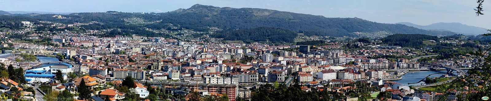
.jpg)
Why people fall for Pontevedra
Portrait drawn from Lonely Planet, the Michelin Green Guide & The Rough Guide.
Just back from the open sea at the head of its namesake ría, at the last bend in the Río Lérez.
On the table. Colonnaded squares buzz with local life; a Sunday paseo when the whole town hits the streets.
Worth the trip
- Praza da Peregrina, with the Baroque Santuario da Virxe Peregrina, its floor shaped like a scallop shell
- Basílica de Santa María, built by the sailors' guild, with busts of Columbus and Hernán Cortés; Columbus's flagship Santa María was built here
- Os Maios festival, lasting the whole of May
Fiestas
- Os Maios, throughout May
A little history
Supposedly founded by a Greek hero returning from the Trojan War; prospered as a medieval fishing port.
Who it suits: Pilgrims on the Camino Portugués · Old-town wanderers
Who Pontevedra is for — and who it isn't
Not our opinion: we ran the same scoring engine behind the quiz for six settler profiles across all 8,132 municipalities and read off where Pontevedra lands.
Good for
- Heat-averse settlers 98th percentile of 8,132 towns 14 km from the sea · mild 25.8°C summer highs
- Families with school-age kids 98th percentile of 8,132 towns 14 km from the sea · a hospital in town
- Remote-working couples 96th percentile of 8,132 towns 14 km from the sea · 83,339 people
- Budget-first coastal settlers 95th percentile of 8,132 towns 14 km from the sea · 83,339 people
- American retirees 90th percentile of 8,132 towns a hospital in town · 14 km from the sea
The numbers
The decision data — each figure placed among all Spanish municipalities that report it ("top 10%" always means good, also where lower is better). Regional overlays and estimates are labelled, and where there's no local reading we say so plainly.
Climate
- Winter average temp
- 10.5°C top 18% of 8,131 towns 2.7°C above the Spanish average (7.8°C)
- Summer high (Jul–Aug)
- 25.8°C top 8% of 8,131 towns 4.4°C below the Spanish average (30.2°C)
- Rainy days a year
- 130 days bottom 3% of 8,088 towns 90% more than the Spanish average (69 days)
- Sunshine
- 6.2 h/day bottom 11% of 3,829 towns 14% less than the Spanish average (7.2 h/day)
- Summer water stress (WEI+) regional estimate
- 7 top 10% of 8,033 towns 49 below the Spanish average (56)
Cost & economy
- Home price
- €2,084/m² bottom 47% of 306 towns 6% less than the Spanish average (€2,208/m²)
- Net income per person
- €15,483 top 34% of 8,059 towns 7% more than the Spanish average (€14,495)
- Income growth ’18–’23
- 25.5% bottom 47% of 6,605 towns
Schools
- Schools in town
- 53 top 1% of 7,042 towns
- Nearest international school
- 3 km top 1% of 8,132 towns
- PISA maths (region) regional estimate
- 486 #8 of 17 regions, +7 vs national 5 above the Spanish average (481)
Healthcare
- Drive to a hospital
- 0 min top 1% of 8,132 towns
- Nearest health centre
- no local data
- Surgical wait (region) regional estimate
- 73 days #3 of 17 regions, −30 days vs national 32% less than the Spanish average (108 days)
Getting around
- Drive to nearest airport
- 28 min top 6% of 8,132 towns
- Fibre-to-home coverage
- 95% top 28% of 8,132 towns 16% above the Spanish average (79%)
- 100 Mbps+ coverage
- 98% top 30% of 8,132 towns 14% above the Spanish average (83%)
Who lives here
- Population
- 83,339
- Born in Spain
- 88.2% 0.6% below the Spanish average (88.8%)
- Born elsewhere in EU/UK
- 1.7% 2.1% below the Spanish average (3.8%)
- U.S.-born residents
- 1.25 per 1,000
Numbers: SpainScore town dataset, derived from INE, AEMET, Mitma and the Catastro. Percentile chips count only the municipalities that report the figure — the "of n" says how many. Region-ranked figures (PISA, surgical waits) compare Spain's 17 comunidades autónomas. A blank means no municipal-level figure is published — not a zero.
The year, month by month
AEMET 30-year climate normals — what a January or an August actually feels like, not the annual average.
How does Pontevedra fit you?
These are the town's numbers. Whether it's your town depends on what you're optimising for — winter sun or mild summers, a city or a village, short medical waits, an easy flight home. The 3-minute quiz scores Pontevedra against every one of Spain's 8,132 municipalities on your priorities. It sits about 32 min from Vigo, if that's your anchor.
Take the quiz — rank Pontevedra for you →Nearby towns
Other places we profile within easy reach.